
Technology & Instrumentation Solutions for Agriculture,
Environment, and Geospatial Surveys
Metaworx Exploration (Private) Limited supplies advanced electronic equipment, meteorological instrumentation, and geospatial survey technology to government, agricultural, and industrial clients across Pakistan.
About
Metaworx Exploration (Private) Limited is a geospatial surveys company specialising in UAV-based surveying, remote sensing, and spatial analytics. We combine advanced unmanned aerial systems with integrated software workflows to deliver accurate, data-driven intelligence that helps organisations plan, monitor, and manage projects with greater confidence and efficiency.
Our work transforms aerial imagery and sensor data into meaningful geospatial information — from mapping large infrastructure projects and monitoring agricultural assets to supporting mineral exploration, water resource planning, and environmental assessment. Driven by innovation and precision, Metaworx delivers reliable, scalable, technology-focused solutions for clients across the commercial, industrial, and public sectors.
Our Mission
- Provide accurate, efficient, technology-driven geospatial solutions through advanced UAV platforms and remote-sensing technologies.
- Transform aerial imagery and sensor data into decision-ready maps, models, and analytics.
- Apply AI-assisted processing to automate feature extraction, classification, and predictive analysis.
- Build sector-specific depth in surveying, hydrology, agronomy, geology, and atmospheric science.
- Extend proven domestic capability into regional markets facing comparable resource and environmental challenges.
Our Vision
- To become a leading provider of geospatial surveys and UAV-enabled analytics, delivering innovative solutions that support sustainable development, smarter infrastructure, and responsible resource management across Pakistan, the Middle East, Africa, and Asia.

Electronic Equipment & Technology Products
Sourcing and integration of advanced electronic systems for commercial and institutional use.
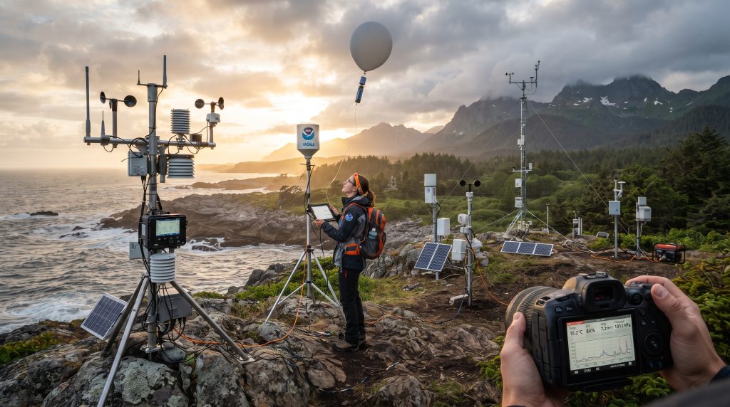
Meteorological & Environmental Testing
Instrumentation and survey technology supporting climate, agriculture, and environmental monitoring.
Import & Export Trade
Licensed trading operations connecting international technology suppliers with Pakistani end users.

CORE CAPABILITIES
What powers every division
Geospatial Surveys
High-accuracy mapping and spatial analytics built on modern UAV and remote-sensing platforms.
Environmental intelligence
Environmental and water data collection and analysis for sustainable planning and climate resilience.
Remote sensing
LiDAR, RGB, multispectral, hyperspectral, and thermal sensing from integrated aerial payloads.
AI-assisted analytics
Machine learning for automated feature extraction, classification, and predictive modelling.
BUSINESS DIVISIONS
Six divisions, one data pipeline
Every engagement draws on the same acquisition, processing, and AI-analytics base — applied to a different part of the earth system.
UAV surveying & mapping
High-precision aerial surveys for engineering, construction, infrastructure, and land-management projects.
LiDAR & remote sensing
Airborne sensing delivering highly accurate terrain and surface information, including beneath vegetation.
Hydrological & water intelligence
Spatial analysis and hydraulic modelling supporting water-resource planning and flood management.
Precision agriculture
Data-driven aerial intelligence that improves agricultural productivity and input efficiency.
Mineral & geological intelligence
Geospatial solutions supporting exploration and mining, from prospecting through production.
Meteorological & cloud seeding
Atmospheric data collection extending into smart, autonomous drone-based rainfall-enhancement support.
APPROACH
Acquire. Process. Analyze. Deliver.
01: Acquire
Advanced UAV platforms capture high-resolution aerial and sensor data.
02: Process
Integrated software workflows turn raw datasets into precise geospatial products.
03: Analyze
Intelligent spatial analytics generate meaningful, decision-ready insight.
04: Deliver
Professional reports, digital maps, 3D models, and GIS-ready datasets.
TECHNOLOGY
Hardware and software, end to end
Advanced UAV platforms, sensor payloads, and integrated software combine for data acquisition, processing, and analytics with speed, consistency, and reliability.
UAV PLATFORMS
- Fixed-wing UAVs
- Multirotor UAVs
- Long-endurance survey platforms
- RTK / PPK navigation systems
SENSOR PAYLOADS
- LiDAR
- RGB cameras
- Multispectral cameras
- Thermal imaging systems
SOFTWARE & ANALYTICS
- Integrated geospatial processing
- AI-assisted image processing
- Automated feature extraction
- Spatial analytics engine
- Cloud-based data management
DELIVERABLES
What clients receive
- Orthomosaic maps
- Digital elevation models
- Digital terrain models
- LiDAR point clouds
- 3D terrain models
- Contour maps
- Vegetation analysis
- Volumetric reports
- Survey reports
- GIS datasets
- Interactive dashboards
- Project analytics
INDUSTRIES
Who we work with
- Mining & natural resources
- Agriculture
- Infrastructure
- Water resources
- Environmental management
- Public sector
- Energy, oil & gas
- Engineering consultants
- Universities & research
Let's map what's next.
contact us
Whether you need aerial surveys, LiDAR mapping, water or environmental intelligence, agricultural analytics, or geospatial consulting — tell us the problem you're working on.
Find us Here
- House 189, Street 12, E-11/4, Islamabad.
Training Hours
- Mon- Fri: 9am- 6pm
- Sat- Sun: Office Close